Perimeter Trail
Perimeter Trail
[05|20|16]
From what I recall, we only did part of the perimeter trail in Ouray this day. I remember finding it way more tiring than I was expecting! This is a classic trail. It has so many dimensions--waterfall, gorges, baby baths, aspen groves, meadows that open up to views of Mt. Abrams, Hayden Mountain... I did do the complete trail the year before in July 2015. I think there was a bit of renovation completed on the trail between those times. I also remember specifically that I did not do any online research prior to hitting the trail, and I went and asked the Visitor’s Center where the trailhead was. Oh, only right across the street! But I do wish I had read this blog post first, from Rocky Mountain Hiking Trails. Below are a few half-assed shots of the part of the trail that we did. I probably didn’t have enough strength to lift my arm. Oh, and it looks like there were some pretty trees in bloom in town, too.
Interested in updates made to the trail? This’ll help you out.


More Posts from Backwoodsnbrush and Others

Wagons preparing to go through an ice tunnel on the Million Dollar Highway near Ironton, Colorado, late spring of 1888.
via reddit
California Pass by Woodbury Lake Via Flickr: California pass between Ouray and Silverton Colorado.
Weehawken Trail
[05|29|2016]
We definitely didn’t finish this trail. We wouldn’t have been able to finish this trail in generally because of it’s difficulty and our lack of preparedness for that. Secondly, it started to rain, which I guess was a bummer, but I recall us being 100% blown away by the difficulty. man0man. I spoke to a co-worker after the hike, and he said “Ohhh. That one. My wife re-named that trail the “We-Walkin” Trail!” Danggg. The Denver Post’s article on the hike does a great job of describing the hike (as I think we only got about a mile--which according to that article is where 1000 ft of the total 2200 elevation gain. Here is another shorter post that may be helpful in terms of directions/data). This wouldn’t be our last time on the trail, and it wouldn’t be our last time on the trail in which we didn’t reach our destination. This is definitely one to bag for...June? It’s hands down going to be one of those hikes that you’ll enjoy more if in better shape. It’s easy to get to which is saying a lot coming from me. ANYWAY we had to end our hike short due to rain--I can’t say it was unwelcomed. As we were not in shape.


Cutler Creek
[05|22|16}
One of the reasons I won’t allow myself to call this a real hiking blog yet is because half of the time we/I didn’t finish the hike because...well I don’t know, at first it felt like there was always something! I also don’t really read maps, use compasses, or have a GPS watch or anything, so those are all goals that I have. In the mean time, I feel that I do need to record my experiences so that I can remember and avoid these sorts of things next time.
Now I’m writing this from a memory of 5 months ago, so I am a giving out a warning that this should be taken with a grain of salt. But I remember the drive there was wack! Nathan has a 4WD truck and we did not feel comfortable driving all the way to the trail head. Pretty sure we had to walk a little more than .5 to the trailhead, and soon after the trail began, a roaring creek prevented us from really going farther--plus we had done the Owl Creek Pass drive earlier that day, which I’ll have to post on another day.
Here are some directions/descriptions for the trail:
Blog 1
Blog 2
Below are some pictures of the creek that made us turn away and the cool view from the crazy drive.


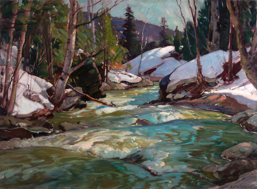
ALDRO HIBBARD Spring Freshet Oil on Canvas 30″ x 40″

Felicity Colorado – instagram.com/caseymac

The Power Plant at Bridal Veil Falls
Telluride, Colorado
Bridal Veil Falls and the Idarado Power Plant make for a great backdrop to this old mining area near Telluride, Colorado.
Sutton Mine Trail
[05|28|16]
So I did the majority of this hike! Lol. There is a theme to my earlier hiking experiences. This blog post from Box Canyon Ouray explains in detail the hike and what to expect. This post from 5280 was helpful too. I was blown away. It was early springtime, especially for the mountains, and everything was a little extra marshy and wet, which was beautiful. Another hiker on the trail had her two dogs who were just diving into the little pools that would collect here and there from the melted snow. There was plenty of that. Melted and unmelted. First, the overlook is gorgeous and worth the what feels like an incline that should take you directly into the sky. Apparently it’s a popular overlook for postcards for Ouray. Then you enter magical marshy and meadowlands, leading to great views of the million dollar highway and the distinct Mt. Abrams. I am eager to finish the hike next season to see Neosho Mine wish is the final point on the trail. The weather got a little dreary after I passed the Bear Creek overlook so I essentially hauled ass after that omen from nature. And made it back to the car safely!


San Juan Mountains (by Candace Dyar)


Rim Rock Drive / Colorado National Monument

30. she|her|hers. montrose, colorado, or the side of the state no one knows about. originally from washington dc social worker, obsessed with my dog, mountains....
219 posts